
Durham’s weekend rain forecast rises as Isaias strengthens
Isaias could bring Durham 1 to 2 inches of rain, mainly late Saturday into Sunday morning. Rain may clear later Sunday, but the timing could still change.

 Wes Platt
This story reflects the National Hurricane Center’s 5 a.m. EDT advisory and NWS Raleigh’s 6 a.m. forecast discussion Thursday, Oct. 8, 2026.
Durham could get 1 to 2 inches of rain this weekend as Hurricane Isaias moves inland from the Gulf Coast, with the wettest stretch expected late Saturday into Sunday morning.
The National Weather Service’s Thursday forecast raises the regional rainfall estimate from roughly an inch a day earlier. Showers should spread into central North Carolina late Saturday, Oct. 10, and continue overnight, with a few thunderstorms possible early Sunday.
There could be some improvement before the weekend ends. Forecasters expect rain to taper off quickly Sunday, with sunshine potentially returning later in the day. The timing isn’t settled enough to count on a dry afternoon.
NWS Raleigh listed no watches, warnings, or advisories in its 6 a.m. Thursday discussion.
However, the office’s hazardous weather outlook now includes the possibility of isolated severe weather Sunday over eastern portions of central North Carolina.
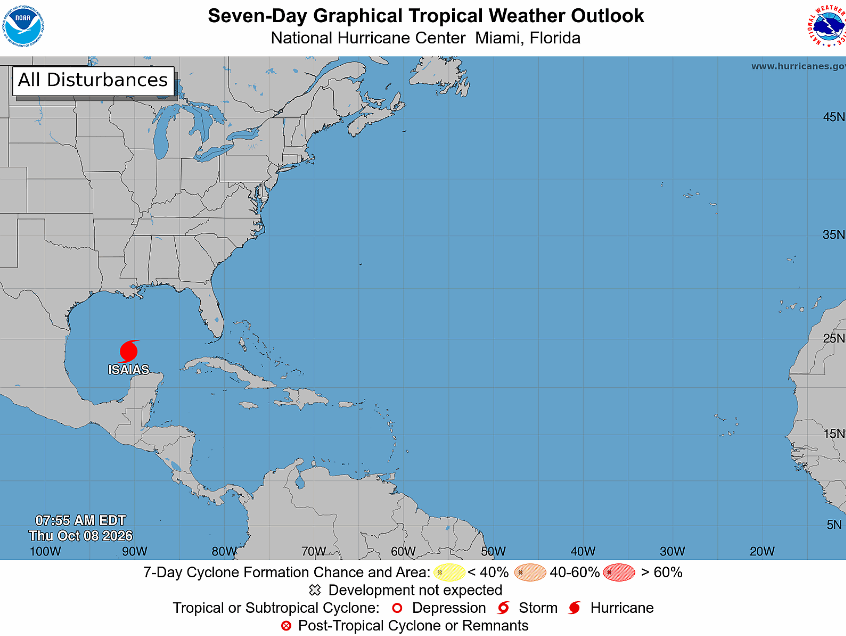
Isaias strengthened into a hurricane late Wednesday. In its 5 a.m. EDT Thursday advisory, the National Hurricane Center reported sustained winds of 80 mph. The storm was about 420 miles south-southwest of the mouth of the Mississippi River, moving east-northeast at 9 mph.
 Wes Platt
Forecasters expect Isaias to turn northeast Thursday, then north Friday, before making landfall along the northern Gulf Coast late Friday or early Saturday. Hurricane warnings extend from Ocean Springs, Mississippi, to Florida’s Bay/Gulf county line.
The hurricane center’s forecast calls for sustained winds to reach about 110 mph early Friday over the Gulf. Some weakening is expected before landfall, but forecasters say Isaias will remain a dangerous hurricane as it reaches the coast.
Once inland, the weakening storm is expected to turn toward the Mississippi and Tennessee valleys. That projected path would keep its center well west of Durham, while rain spreads across the Carolinas.
Get Connected

- Send email to your neighborhood news guy: wes.platt@southpointaccess.news
- Follow on Threads.
- Connect on Instagram!
- Join our Discord community
- Join the Southpoint Access subreddit!
 Wes Platt
🤝 Support Our Sponsors
Local journalism in South Durham survives thanks to the generous businesses and organizations that make this work possible. 🧭
By supporting these sponsors, you’re helping Southpoint Access continue to deliver trusted, hyperlocal news and resources for our community - from school updates to neighborhood stories that keep South Durham connected.
Want to become a sponsor? Sign up here!
💛 Shop local. Hire local. Support those who support Southpoint Access.





![[SoDu We Dine] Two South Durham restaurants receive B grades in latest inspections](https://storage.ghost.io/c/50/33/50334374-93a7-4cf9-ba69-d7d51c63be2a/content/images/size/w600/2026/10/diningguide829.png)
![[SoDu Stuff to Do] Your Weekend Ahead - Oct. 8, 2026](https://storage.ghost.io/c/50/33/50334374-93a7-4cf9-ba69-d7d51c63be2a/content/images/size/w600/2026/06/stufftodo618.png)