
Durham faces damaging wind, brief tornado risks Sunday
Durham could see damaging winds and brief tornadoes Sunday, with the main storm risk between 11 a.m. and 6 p.m. Here’s what to know before heading out.

 Wes Platt
This story reflects the NWS Raleigh’s 6:40 a.m. forecast discussion and 3:12 a.m. hazardous weather outlook. Check NWS Raleigh for current alerts.
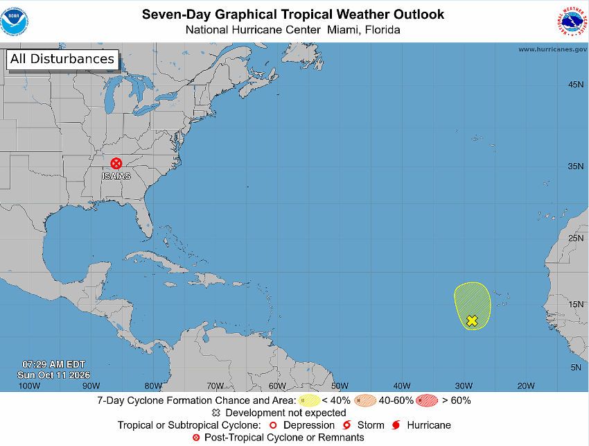
Durham residents should keep an eye on weather alerts Sunday as storms associated with the remnants of Isaias could bring damaging winds and brief tornadoes.
The National Weather Service has Durham County in a Level 2 slight risk area for severe storms. That’s an increase from the marginal risk outlined Friday, when rain was the main concern in the local forecast. Today’s outlook calls for the possibility of damaging winds and a few tornadoes with short paths from late morning into early evening.
Forecasters identify 11 a.m. to 6 p.m. as the main window for severe weather, with the threat expected to diminish substantially after 6 p.m.
 Wes Platt
A broken band of showers and thunderstorms is expected to move east-northeast across central North Carolina ahead of a cold front. Forecasters aren’t certain how widespread the storms will be, but some could become severe.
The greatest risk for brief tornadoes appears to extend from the Triangle north and east toward Henderson, Rocky Mount, Goldsboro, and Roanoke Rapids. A brief tornado could occur elsewhere in central North Carolina, too, and strong to severe wind gusts are possible across the region.
Isaias’ remnants were over eastern Tennessee early Sunday and are expected to move toward the Mid-Atlantic later today. The storm’s center doesn’t have to pass over Durham for local thunderstorms to pose a risk.
NWS Raleigh listed no watches, warnings, or advisories in its 6:40 a.m. forecast discussion. That status can change as storms develop, so check current alerts before heading out.
For anyone attending outdoor events or spending time away from home, identify a sturdy building where you can take shelter and keep a way to receive weather alerts. A tent isn’t safe shelter from a tornado.
If a tornado warning includes your location, move promptly to a basement, safe room, or interior room away from windows.
Get Connected

- Send email to your neighborhood news guy: wes.platt@southpointaccess.news
- Follow on Threads.
- Connect on Instagram!
- Join our Discord community
- Join the Southpoint Access subreddit!
 Wes Platt
🤝 Support Our Sponsors
Local journalism in South Durham survives thanks to the generous businesses and organizations that make this work possible. 🧭
By supporting these sponsors, you’re helping Southpoint Access continue to deliver trusted, hyperlocal news and resources for our community - from school updates to neighborhood stories that keep South Durham connected.
Want to become a sponsor? Sign up here!
💛 Shop local. Hire local. Support those who support Southpoint Access.





![[Video] Nerdspresso Phase II: Next-Gen Horror](https://storage.ghost.io/c/50/33/50334374-93a7-4cf9-ba69-d7d51c63be2a/content/images/size/w600/2026/10/obsession.jpg)

![[The Gourmand Next Door] What's So Super About "Super Tuscans?"](https://storage.ghost.io/c/50/33/50334374-93a7-4cf9-ba69-d7d51c63be2a/content/images/size/w600/2026/10/25fb1f99ec4d2f26814c317a88653efe.jpg)
![[SoDu We Work] Public service and campus jobs lead this week’s SoDu guide additions](https://storage.ghost.io/c/50/33/50334374-93a7-4cf9-ba69-d7d51c63be2a/content/images/size/w600/2026/10/jobsguide829.png)